Hiking in Naturns
Hiking suggestions for Naturns and surroundings
If you're looking for activities during your holiday in South Tyrol then hiking should be at the top of your list.
In Naturno hikers have 3 types of contrasting landscapes at their disposition in which to move freely surrounded by nature: Hiking in the apple orchards at the base of the valley around Merano with its mild Mediterranean climate. Hiking at medium altitude between the valley floor and 1,500 metres. And hiking at high altitude in the mountains over the tree line and up to 3,000m on the peaks of the Texel Group of mountains.
If you avert your gaze upwards from the valley floor to the sides you will see Sonnenberg mountain (sunny mountain - a very apt name) and Nörderberg mountain, two landscapes with very few similarities.
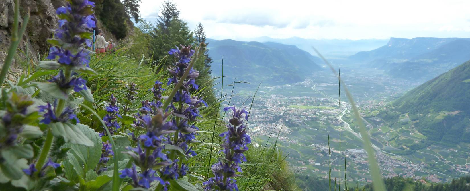
The Meran Höhenweg
A relatively easy path, it stays at virtually the same altitude as it meanders its way through the high mountain landscape of the Texel Group with wonderful views down towards the Mediterranean vegetation of the nearby Adige valley. The panorama takes in the green Val Venosta valley and the Merano basin as well as the Passiria and Sarentino valleys and the Stubai and Ötz valley Alps. On a clear day you can see as far as the mighty Dolomites, the Brenta Group and the magnificent Ortler.
The Höhenweg, which is divided into a north and south section is 90 km long and is safe at most times of the year. Generally-speaking, the best season is from the end of June to October, barring unseasonal snowfall. The southern and eastern parts are usually free of snow all year round and are ideal for a one-day hike.
You can walk part of the Merano Höhenweg in a day or choose to take a longer two, three or even five to seven-day trek if you decide to do the whole circuit. Public transport including cable-cars and chairlifts, various shuttle services and private taxi will get you to one of the many starting points along the path and, for your safety, all exposed or over-hanging stretches are well-fitted with railings, ladders, steps or steel ropes.
Although there are paths leading down all along the Höhenweg, you should not forget that you are at a relatively high mountain altitude and must be healthy, fit and in good condition, have a local map with you and sturdy hiking shoes as well as suitable protective clothing as prevailing weather conditions can change with very little warning. The Naturno Tourist Authority Office stocks a good selection of maps covering the Texel Nature Park and the Merano Höhenweg itself.
Please note that you will need to arrange your own over-night accommodation in the mountain refuge huts along the way. There is ample choice but check to see there are enough beds available and whether the refuge hut in question is open at that particular time or not. Always ask the hut owner about the condition of the path before setting out on the next part of your trek. He or she will be happy to give their expert advice!
We hope you'll enjoy your hike along the Merano Höhenweg and return safe and sound to Naturno at the end of it!